
Efficient Spatiotemporal Super-Resolution of Urban Microclimates for Heat Wave adaptation


III Jornadas Red URBAN MOME. Madrid, 23 Febrero 2026
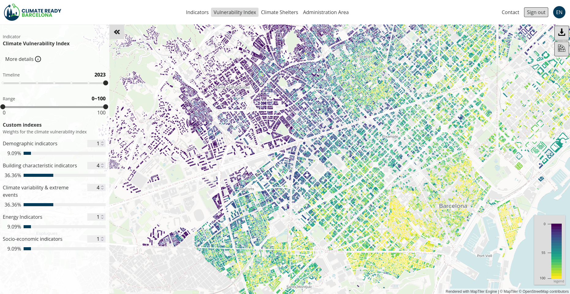
Vulnerability map: Climate-Ready BCN
Source: ICLEI Action Fund 2.0
Budget: €1M
Objective: Support citizens and public authorities in adapting to extreme climate events and reducing energy poverty
Implemented: From May 2023 to December 2025


Climate Vulnerability in Barcelona at building level
The Climate Vulnerability Map of Barcelona is a geospatial analysis tool that identifies buildings most at risk during extreme heat events.
It evaluates key performance indicators (KPIs) for buildings and supports climate change planning.
The framework is based on the dimensions defined in the IPCC’s Third Assessment Report: Exposure, Sensitivity, and Adaptive Capacity.
It provides an assessment of all residential buildings in Barcelona(61,000)
What is it?
CVI
The need for high-resolution climate data
Vulnerability index to asses heat wave resilience
- Multidimensional Assessment: The Climate Vulnerability Index (CVI) aggregates socioeconomic, infrastructural, and climate variability KPIs (e.g., temperature) to evaluate risk at the building level.
- The Resolution Gap: Traditional meteorological forecasts provide coarse regional data, lacking the spatial granularity required to assess individual building exposure.
- The Missing Link: To accurately calculate the CVI in real time, we require a dynamic predictive model that captures urban microclimates and street-level heat-island effects.
Data sources & harmonization
BEEMind: Data ontology
The ontology at the core of our solutions
Applied semantic web technologies:
- To manage the complexity of urban data, the project implements a Semantic Data Modeling strategy that transforms fragmented information into a unified, queryable structure.
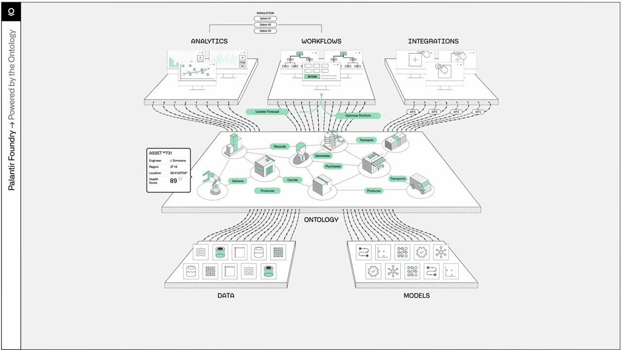
Massive data integration
Data sources
Big numbers
Massive data integration
61,000
1 Milion
200.000
Buildings


Households
EPC

10,222
3 Milion
20.000
Zones (microcli-mate model)
KPIs visualized
Heat waves warnings and tips
1,050
Households
Modelling
Model Deployment: Triggering Heat Wave Alerts
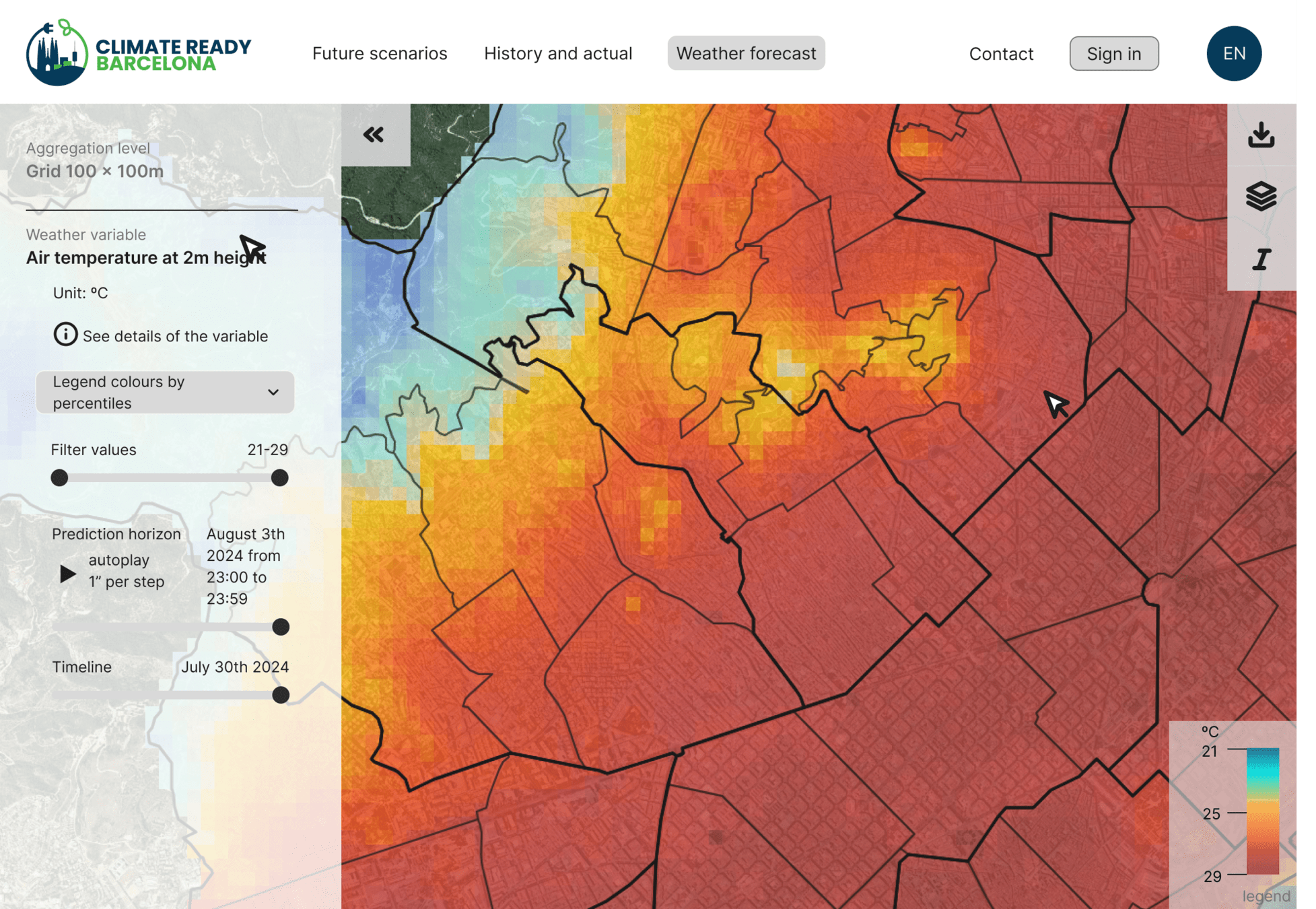
The Predictive Engine
Weather
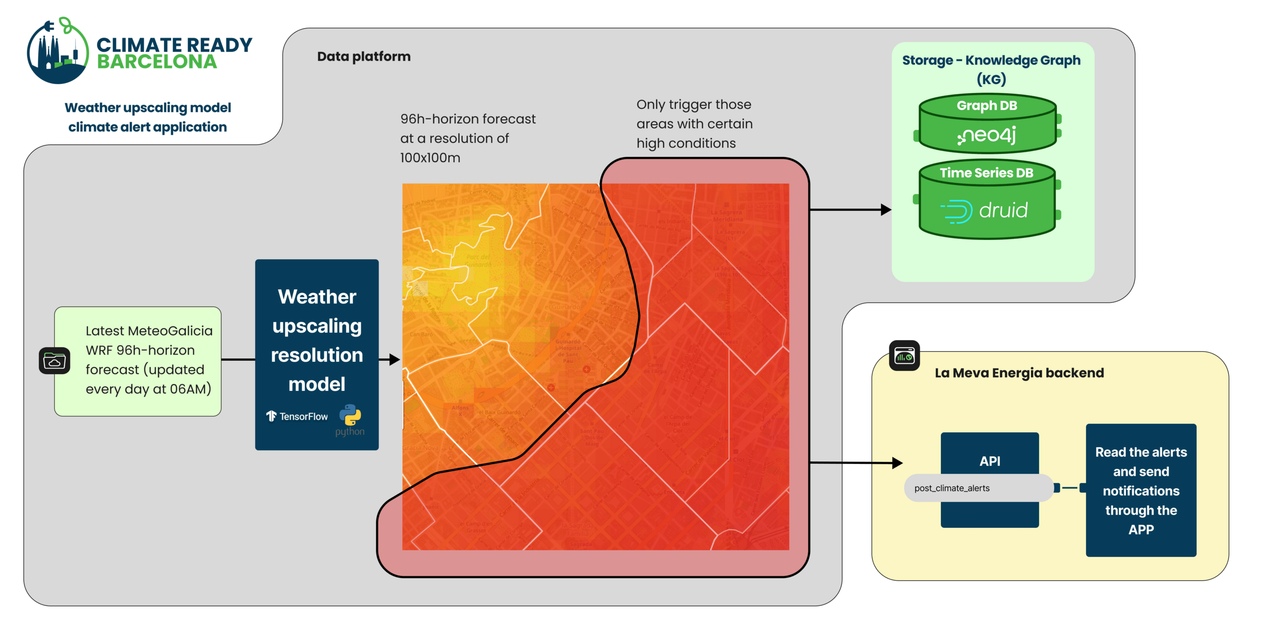
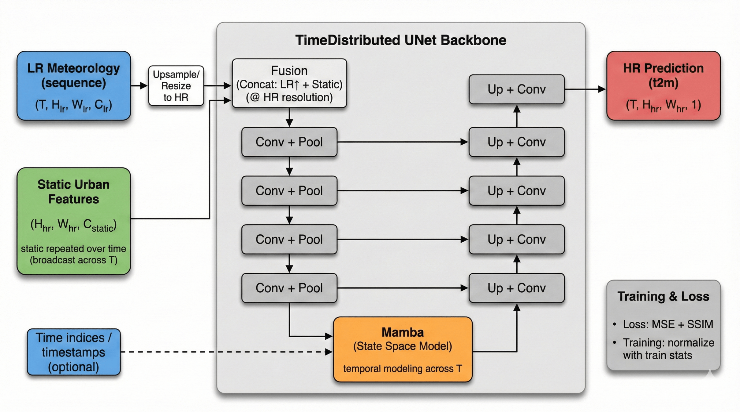
UNDynamic Downscaling of Urban Microclimateset + Mamba (Hybrid Spatiotemporal Weather Downscaling)
AI-Driven Spatiotemporal Super-Resolution
Vulnerability map
- Generate high-resolution urban temperature maps (HR t2m) from low-resolution meteorology (LR) + static urban context.
- UNet Encoder–Decoder (2D): Extracts and reconstructs multi-scale spatial detail.
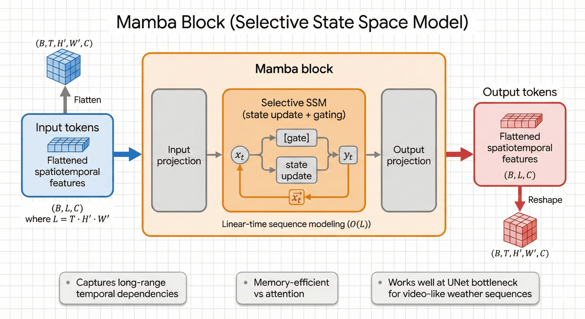
- Mamba Block (SSM): Models long-range temporal dependencies with better scalability than attention.
- Hybrid loss (MSE + SSIM) for numerical fidelity + spatial structure.
- A selective State Space Model (SSM) block for efficient sequence modeling
- Learn a gated, input-dependent state update that mixes information along the sequence with linear scaling in sequence length.
- Captures long-range temporal dependencies without quadratic attention cost.
- Memory-efficient and stable for longer sequences (e.g., seq=6 → seq=12).
Mamba Block / Temporal Modeling
Weather
Results
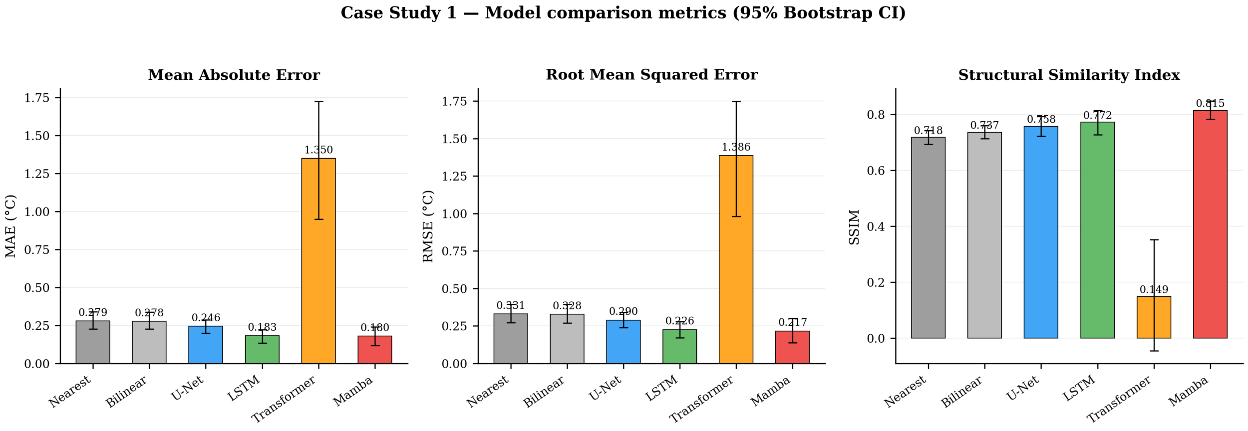
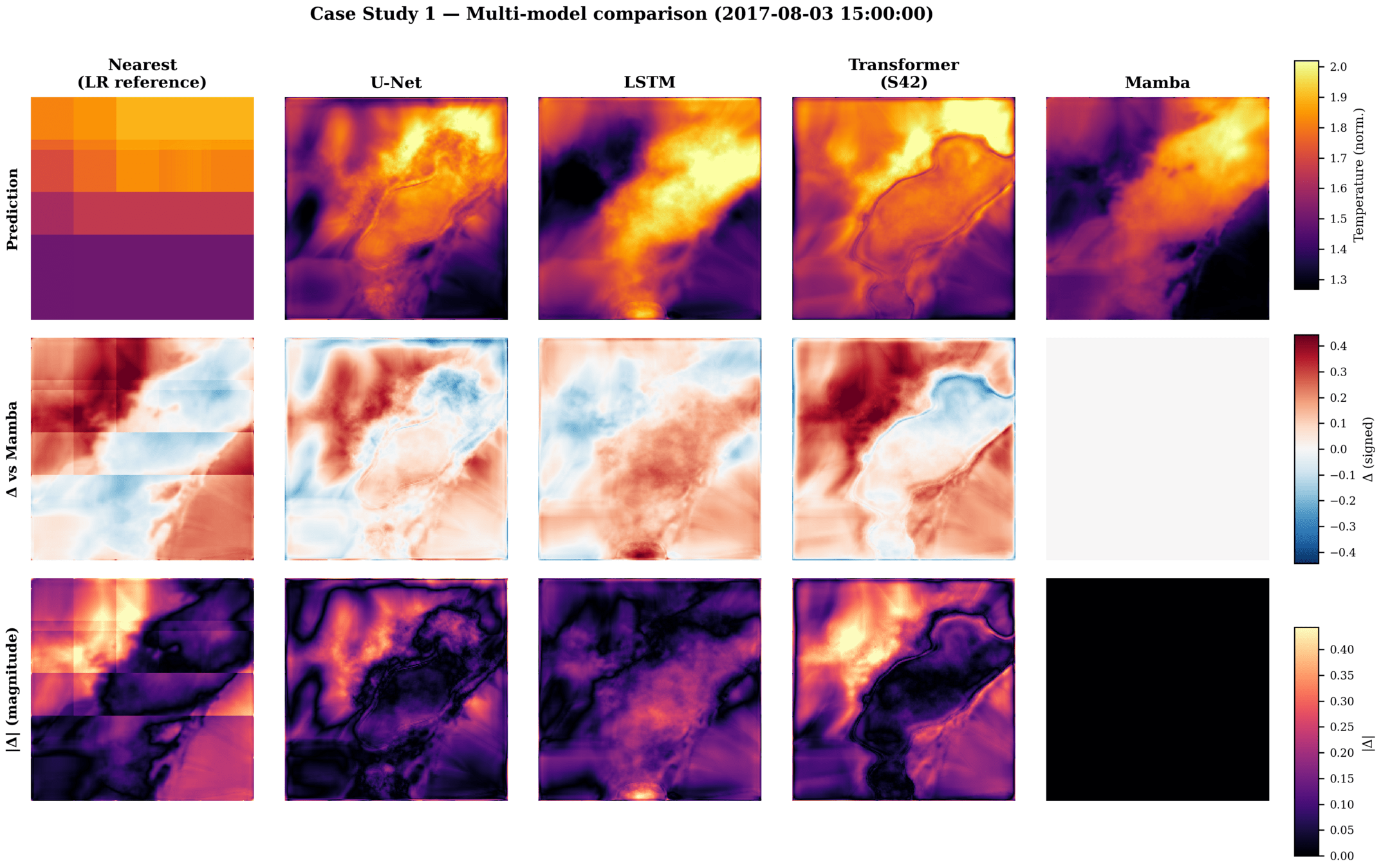
Model Validation during Extreme Events
Case Study: 2017 Summer Heatwaves (AEMET)
-
Superior Accuracy: The UNet+Mamba architecture outperformed all baselines, achieving a 34% reduction in RMSE compared to standard upscaling.
-
Structural Preservation: Mamba significantly better preserves complex urban spatial structures (SSIM of 0.815) compared to temporal alternatives like LSTM.
-
Efficiency vs. Transformers: Standard Transformers exhibited severe training instability and catastrophic divergence (SSIM < 0)
Vulnerability map
Vulnerability map
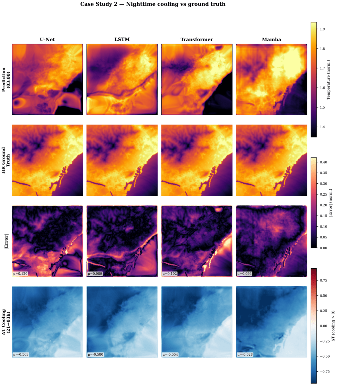
Case Study: Full-Frame Cooling Deficit Mapping
- Ranking Stability: Mamba remains the uncontested #1 model even when scaling from local tiles to full-frame city inference.
- Tracking the Cooling Deficit: Successfully captures fine urban cooling gradients (mean ΔT = −0.628°C), revealing areas where nighttime cooling fails completely.
- Identifying Structural Vulnerability: The model isolated the ~4.2% of the urban domain that suffers from persistent heat islands.
Vulnerability map
Actionable Intelligence: Night-time Heat Persistence
Vulnerability map
Actionable Intelligence: Night-time Heat Persistence
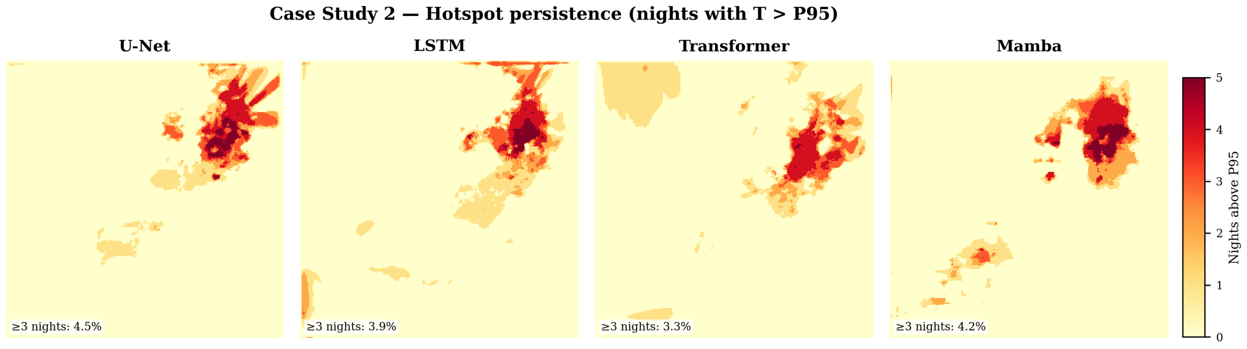
-
Revealing Hidden Microclimates: The model successfully detects fine-scale thermal hotspots at the street and block level that are completely invisible to regional models.
-
Nighttime Heat Persistence (Cooling Deficit): Accurately maps areas where nighttime cooling fails during heatwaves, identifying structural adaptation priorities.
-
Actionable Intelligence: Provides the precise, high-resolution data required to trigger localized climate alerts and guide tactical urban planning.
Thank you
Kerin Cardona
Research Engineer / BEEGroup
kcardona@cimne.upc.edu
UrbanMome-feb2026
By CIMNE BEE Group
UrbanMome-feb2026
Solucions basades en intel·ligència artificial per a l'augment de la resiliència climàtica en edificis i entorns urbans


